


Norway, Trollstigen & Geiranger
_edited.jpg)
As a motorcycle rider, Norway has to be one of the most amazing places to go. And especially if you are a motorcycle camping enthusiast. It is full of nature and camping possibilities are everywhere. And the camping feels wild! Like you are part of some exploration expedition.
If you haven't visited Norway on a motorcycle here are my tips from my first solo motorcycle trip through Norway's most scenic roads and camping spots.
TROLLSTIGEN
Trollstigen, or "The Troll's Ladder", is one of Norway's most iconic and dramatic mountain roads. Known for its extreme engineering and mythical atmosphere, it is part of the Norwegian Scenic Route Geiranger–Trollstigen.
Engineering & Road Features
-
The 11 Hairpin Bends: The road is famous for its 11 razor-sharp switchbacks that climb a nearly vertical mountainside at a steep 9% to 10% gradient.
-
Named Corners: Each of the 11 bends has its own name, mostly honoring the foremen who led the construction crews during its building.
-
A Decades-Long Project: Construction began in 1916 and took 20 years to complete due to the harsh terrain and funding challenges. It was officially opened on 31 July 1936 by King Haakon VII.
-
Modern Viewing Platforms: At the summit (Stigrøra, 858 metres above sea level), the Trollstigen Visitor Centre features architect-designed platforms made of steel and glass that extend over the cliff edge.
Nature & Folklore
-
Stigfossen Waterfall: As you drive, the massive 320-metre Stigfossen waterfall drops right beside the road. An iconic natural stone bridge carries vehicles directly across the falling water.
-
The "Royal" Peaks: The road is surrounded by towering mountains with majestic names: Bispen (The Bishop), Kongen (The King), and Dronninga (The Queen).
-
Petrified Trolls: According to local legend, trolls who were caught out in the sunlight were turned to stone, forming the jagged peaks of the surrounding mountains.
-
Ancient Path: Long before the road, a primitive packhorse track (bridleway) existed for centuries. Parts of this original stone-laid track are still visible alongside the modern road.


_edited.jpg)
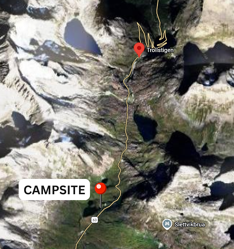
Once you reach the top of Trollstigen (the Trollstigen Plateau), camping options are primarily wild camping.
Wild Camping at the Summit
Under Norway’s Right to Roam (Allemannsretten), you can pitch a tent on uncultivated land for up to two nights, but strict local rules apply at this popular tourist site:
-
Tent Camping: You may pitch a tent in the mountains away from the immediate plateau infrastructure. You must stay at least 150 metres from any buildings (like the Visitor Centre).
-
Leave No Trace: The alpine environment is extremely fragile. Campers are required to carry out all waste and avoid camping on vulnerable vegetation.
I found the absoloute best camping place with the most beautiful backdrop and if it is not taken, I highly recommend that you go here!
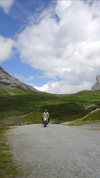


GEIRANGER
Geiranger is a UNESCO World Heritage-listed village and fjord in Norway's Sunnmøre region, renowned for its dramatic 800-meter cliffs, deep blue waters, and iconic waterfalls like the Seven Sisters. It is a premier tourist destination offering fjord cruises, kayaking, and panoramic viewpoints like Dalsnibba and Flydalsjuvet.
The Geirangerfjord
The fjord itself is a 15-kilometre-long branch of the larger Storfjord, carved by glaciers during successive ice ages.
-
Iconic Waterfalls: The fjord is home to world-famous waterfalls, including the Seven Sisters (De syv søstrene), The Suitor (Friaren), and The Bridal Veil (Brudesløret).
-
Abandoned Farms: Historic mountain farms like Skageflå and Knivsflå cling to the steep cliffs, offering a glimpse into traditional fjord life.
-
UNESCO Status: It shares its heritage status with the Nærøyfjord as part of the West Norwegian Fjord landscape.
Key Sights & Activities
-
Viewpoints:
-
Geiranger Skywalk (Dalsnibba): A glass-floored platform 1,500 metres above sea level, offering 360-degree views.
-
Ørnesvingen (Eagle Road): The steepest stretch of road with 11 hairpin bends and a panoramic balcony.
-
Flydalsjuvet: A popular photo spot overlooking the village and fjord.
-


Djupvatnet
Djupvatnet is a high-alpine, deep-blue lake located approximately 12 kilometres southeast of Geiranger along County Road 63. Sitting at an altitude of 1,016 metres above sea level, it serves as a dramatic transition point between the lush Geirangerfjord and the rugged mountain peaks.
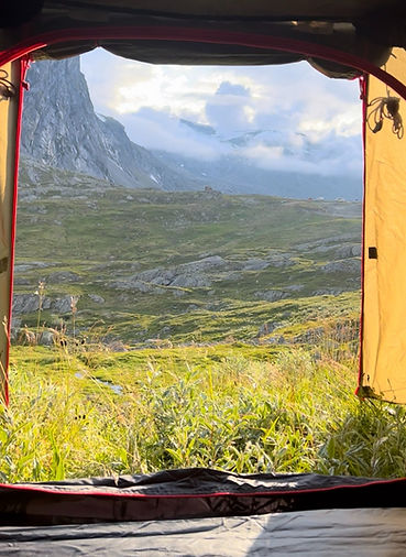
This was also one of the most beautiful camping locations I've ever had even though I literally camped just off the side of the road. I was very very lucky with the weather and had the most amazing sunset photos of the bike and the tent with the mountains in the background. There wasn't a lot of traffic at all so sleeping next to the road was not a problem whatsoever.

Key Features & Sights
-
Glacial Appearance: The lake is known for its icy character; it is often frozen or filled with snowdrifts well into July. Its name translates to "Deep Water," reflecting its maximum depth of 200 metres.
-
Dalsnibba Skywalk: Djupvatnet is most famous as the gateway to the Dalsnibba Skywalk. The Nibbevegen toll road begins at the lake's edge and climbs to 1,500 metres for one of Europe’s most famous fjord views.
-
Djupvasshytta: Located right on the shore, this historic lodge and restaurant offers a rest stop with food, a gift shop, and simple accommodation.
Activities
-
Photography: The lake provides a stark, high-alpine contrast to the green fjord below, with many pull-off points for photos.
-
Hiking: Popular trails include the trek from Djupvasshytta to Dalsnibba or longer routes like the one to Kaldhusseter via Fagerbotnvatnet.
Practical Travel Info
-
Access: Reachable in about 20–30 minutes from Geiranger via the winding Geirangervegen road.
-
Seasonal Closures: The road (Fv63) passing the lake is closed in winter, typically from November/January until late April or June, depending on snow conditions.
-
Weather: It is significantly colder than the village level; bring warm layers even in summer.


Slådalsvegen
Slådalsvegen is a high-mountain gravel road that connects Vågåmo in Vågå municipality to Lesja. Spanning approximately 32 kilometres, it is often called a "panorama road" for its expansive views of the Reinheimen National Park and the Dovrefjell-Sunndalsfjella National Park to the east.


Route & Driving Conditions
-
Surface: The road is an unpaved gravel track. While it is generally well-maintained and suitable for standard cars and motorcycles, it is a narrow mountain pass that requires slow speeds.
-
Highest Point: The road reaches an elevation of 1,180 metres above sea level as it crosses the mountain plateau.
-
Hazards: Expect to encounter free-roaming livestock, particularly sheep and cattle, standing directly on the road.
-
Weight Limit: There is a partial weight limit of 6 tonnes on the Vågå side of the pass.
Access & Seasonal Information
-
Seasonal Opening: Slådalsvegen is a summer-only road. It typically opens the first Monday after May 17th, though this varies depending on snow conditions.
-
Closure: The road closes for the winter when the first significant snow arrives, usually in October.
-
Current Status: In 2025, the road officially opened on May 21st.
Toll & Payment
-
Cost: The toll fee is 100 NOK, applicable to both cars and motorcycles.
-
Payment Method: The toll is managed via automatic license plate recognition. You can pay online at Passpay within 48 hours of passing to avoid an invoice fee.
Aursjövegen
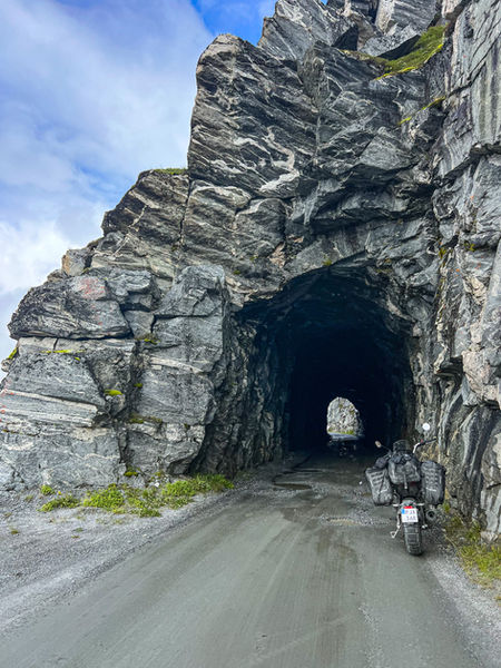
Aursjøvegen is a dramatic 121 km mountain road in Møre og Romsdal, often called "Norway's wildest detour". It connects Sunndalsøra to Eikesdalen, crossing rugged alpine terrain that was originally developed as a construction road for the Aura power plant. The road is majority offroad, has a tunnel and the cliff-side views are spectacular.



Status and Seasonal Access
-
Expected Opening: It typically opens on June 1st. In 2025, it officially opened on June 1st, though this always depends on snowmelt.
-
Closing: The road closes when the first significant snow arrives in October or November.
-
Potential 2026 Restrictions: Environmental authorities are considering new measures to protect wild reindeer in the Dovrefjell-Snøhetta region, which may result in stricter access or partial closures for motor traffic on sections near Aursjøen starting in 2026.
Driving Experience & Safety
-
The Route: The road is largely unpaved gravel with steep sections and 180-degree hairpin turns. It features a unique unlit tunnel at Finnsetlia that actually circles inside the mountain.
-
Vehicle Suitability: While standard passenger cars can manage the trip, it is not recommended for caravans or large motorhomes due to narrow tunnels and sharp bends. Perfect for motorcycles.
-
Road Hazards: Drivers should be prepared for narrow stretches without guardrails and steep drops.
Tolls and Payment
-
Cost: The toll for a standard passenger vehicle is 100 NOK.
-
Payment: The toll stations are located at Litldalen (Sunndal) and Finnset (Nesset). Payment is typically card-only via automatic barrier systems or automatic plate recognition.